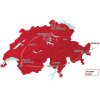
Tour de Suisse 2017 Route stage 7: Zernez – Sölden (Aut)
Slideshow 1/10
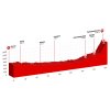
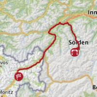
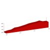
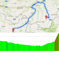
Friday, 16 June 2017 - At 166.3 kilometres, stage 7 in the Tour de Suisse is a prolonged preparation for the closing climb. The route travels from Zernez to the Tiefenbachferner in the mountains high above Sölden, Austria. To arrive at the finish the riders have to climb 14.2 kilometres at an average gradient of 9.5%. This is the Queen Stage.
The Tiefenbachferner is a glacier at an elevation of 2,790 metres. In recent years the Tour de Suisse arrived at the nearby Rettenbachferner, which was a 12.1 kilometres climb at 10.8% – so shorter and steeper. This makes sense. The Tiefenbachferner ascent is exactly the same, only slightly longer. Since the last few kilometres are not a steep as the first twelve the average inclination tuns out somewhat lower. Yet, it’s obvious the Tiefenbachferner is tougher than the Rettenbachferner as it is the same climb, only longer.
In last two editions of the Tour de Suisse, Thibaut Pinot (2015) and Tejay van Garderen (2016) climbed to victory on the Rettenbachferner.
Stage 7 leaves from Zernez, located in Engadin, which is a long and high Alpine valley. The start is at an altitude of 1,463 metres and in some 100 kilometres the riders descent to 700 metres. Following a more or less flat intermezzo of 15 kilometres the roads begin to rise and they will do so for the last 52 kilometres.
At first it’s a gentle inclination – a false flat. The riders enter the Ötztal to follow the river Ötztaler Ache upstream. Passing through the villages Au and Längenfeld the route turns right in Sölden to hit the Gletscherstrasse. This is the beginning of the closing climb. First it goes to the Rettenbachferner – 12.1 kilometres at 10.8% -, but instead of turning right to power to the finish line the route goes right for 3 more kilometres at 6%.
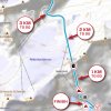
Two intermediate sprints – at kilometre 136.1 and at kilometre 1502 – come with time bonuses of 3, 2 and 1 seconds each, while the first three riders on the line at the Tiefenbachferner take 10, 6 and 4 seconds.
Read also: results/race report 7th stage 2017 Tour de Suisse.
Tour de Suisse 2017 stage 7: Route maps, height profiles, and more
Click on the images to zoom
+ Click for more images (6)
Watch the highlights of recent races here:
Related articles Favourites - Tour de Suisse 2017 Overview - Tour de Suisse 2017 Rohan Dennis wins ITT in Schaffhausen, Simon Spilak takes overall victory - Tour de Suisse 2017 Superior sprint victory Sagan, Spilak retains in overall lead - Tour de Suisse 2017 Pozzovivo wins in La Punt to take yellow jersey - Tour de Suisse 2017 Peter Sagan powers to victory, Caruso retains in lead - Tour de Suisse 2017 Warbasse solos to mountain victory, Caruso new leader - Tour de Suisse 2017 Stage win and leaders jersey Michael Matthews - Tour de Suisse 2017 Sprint victory Philippe Gilbert, Stefan Küng new leader - Tour de Suisse 2017 Rohan Dennis powers to stage win and leaders jersey in short ITT - Tour de Suisse 2017 Route stage 1: ITT in Cham - Tour de Suisse 2017 Route stage 2: Cham - Cham - Tour de Suisse 2017 Route stage 3: Menziken – Bern - Tour de Suisse 2017 Route stage 4: Bern – Villars sur Ollon - Tour de Suisse 2017 Route stage 5: Bex – Cevio - Tour de Suisse 2017 Route stage 6: Locarno – La Punt - Tour de Suisse 2017 Route stage 8: Criterium in Schaffhausen - Tour de Suisse 2017 More articles Tour of the Basque Country 2025: Aranburu wins thrilling stage, Schachmann cements lead
Tour of the Basque Country 2025 Route stage 4: Beasain - Markina-Xemein
Tour of the Basque Country 2025: Riders
Tour of the Basque Country 2025 Route stage 5: Urduña - Gernika-Lumo
Tour of the Basque Country 2025 Route stage 6: Eibar - Eibar
Paris - Roubaix 2025: The Route
Paris - Roubaix 2025: Riders
Paris - Roubaix 2025: Favourites
Paris - Roubaix Femmes 2025: Route
Paris - Roubaix Femmes 2025: Riders
Amstel Gold Race 2025: The Route
Amstel Gold Race 2025: Riders
Liège-Bastogne-Liège 2025: The Route
Liège-Bastogne-Liège 2025: Riders
Giro 2025: The Route
Giro 2025: Riders
Giro 2025 Route stage 1: Durazzo - Tirana
Giro 2025 Route stage 2: Tirana - Tirana
Giro 2025 Route stage 20: Verrès – Sestrière
Tour de France 2025: The Route
Tour de France 2025 Route stage 1: Lille - Lille
Tour de France 2025 Route stage 12: Auch - Hautacam
Tour de France 2025 Route stage 14: Pau - Superbagnères
Tour de France 2025 Route stage 16: Montpellier - Mont Ventoux
Tour de France 2025 Route stage 18: Vif - Col de la Loze
Cycling Calendar 2025

