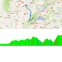
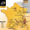
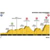
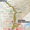
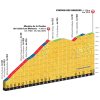
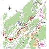
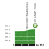
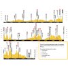
The first 28 kilometres of stage 8 are the quiet before the storm. Then, starting in the village Arbois, the road goes up and down until the dyings metres of the race. Yet, the first real climb looms with 95 kilometres done. The Col de la Joux, peaking at 1,035 metres, is a 6.1 kilometres ascent with an average gradient of 4.6%.
A long drop takes the riders to the foot of the Côte de Viry. This is a 7.6 kilometres climb at 5.2%, that’s crested at kilometre 138.5 in the saddle.
Following a hilly section the pilots plunge down to Saint-Claude for the start of the finale. The last climb is called Montee de la Combe de Laisia Les Molunes, which is not only a long name, it’s a long ascent, too. Not the toughest t you can think of though. The Montee de la Combe de Laisia Les Molunes amounts to 11.7 kilometres, while the slope is averaging 6.4%. The summit lies at an elevation of 1,202 metres.
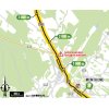
Still 11 kilometres left to race, in which to descend to 1,107 metres. So that’s not a descent at all. A rolling section runs to the finish line in the ski station of Les Rousses, close to the Swiss border.
In the Tour de France of 2010, Sylvain Chavanel soloed to victory in Station des Rousses.
The first three riders on the line take time bonuses of 10, 6 and 4 seconds.
Read also: results/race report 8th stage 2017 Tour de France.
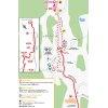
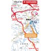
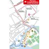
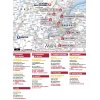
Tour de France 2017 stage 8: Route maps, height profiles, and more
Click on the images to zoom
+ Click for more images (16)
Related articles Riders - Tour de France 2017 Withdrawals - Tour de France 2017 Route and stages - Tour de France 2017 stage 20: Start times ITT - Tour de France 2017 stage 1: Start times ITT - Tour de France 2017 GC Favourites - Tour de France 2017 More articles Giro 2025: The Route
Giro 2025: Riders
Giro 2025: GC Favourites
Giro 2025 Route stage 1: Durazzo - Tirana
Giro 2025 Favourites stage 1: Puncher's sprint for pink
Giro 2025 Route stage 2: Tirana - Tirana
Giro 2025 Favourites stage 2: Chrono specialists to the fore
Giro 2025 Route stage 3: Valona – Valona
Giro 2025 Favourites stage 3: Breakaway day
Giro 2025 Route stage 4: Alberobello – Lecce
Giro 2025 Favourites stage 4: For fast men #1
Giro 2025 Route stage 5: Ceglie Messapica - Matera
Giro 2025 Favourites stage 5: For fast men #2
Giro 2025 Route stage 6: Potenza - Naples
Giro 2025 Favourites stage 6: Hilly race with flat finale
Giro 2025 Route stage 7: Castel di Sangro - Tagliacozzo
Giro 2025 Favourites stage 7: First mountain top finish
Giro 2025 Route stage 8: Giulianova – Castelraimondo
Giro 2025 Favourites stage 8: Attackers in the Apennines
Giro 2025 Route stage 9: Gubbio - Siena
Giro 2025 Favourites stage 9: Strade Bianche alla Giro
Vuelta Femenina 2025: Van der Breggen wins with late attack, Gerritse retains GC lead
Vuelta Femenina 2025 Route stage 5: Golmayo - Lagunas de Neila
Giro 2025 Route stage 10: Lucca – Pisa
Cycling Calendar 2025
Tour de France 2025: The Route
Tour de France 2025 Route stage 1: Lille - Lille
Tour de France 2025 Route stage 2: Lauwin-Planque - Boulogne-sur-Mer
Tour de France 2025 Route stage 3: Valenciennes - Dunkirk
