Tour de France 2016 Route stage 1: Mont Saint-Michel - Utah Beach
Slideshow 1/10
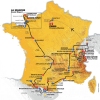
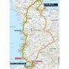
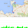
Saturday, July 2, 2016 – Stage 1 of the Tour de France starts in the picturesque town of Mont Saint-Michel. The most likely outcome after 188 kilometres of racing through Normandy is a bunch sprint. Utah Beach was one of the code names of the Allied Invasion in World War II.
Mont Saint-Michel is one of the main tourist-attractions in Normandy. Annually about three million visitors go see the rock island just off the coast, crowned by an imposing Benedictine Abbey. About 1,300 years ago the Abbey was built on a cliff overlooking the sea, while the other side was covered in forests. But a tidal wave swept out trees and earth, and the rock island became accessible only at low tide.
In 1879 a causeway was built, connecting the island to the mainland. In December 2014 the old connection was replaced by a pedestrian bridge, so the first 760 metres of the 2016 Tour de France will be on a route that is actually intended for hikers. The stage leads through the rolling Normandy landscape to Utah Beach. This was during D-Day 1944 the westernmost landing of the Allies. Utah Beach is 6 kilometres from the village of Sainte-Marie-du-Mont.
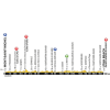
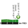
Two hills come with a KOM category, namely Côte d’Avranches – crested after 20.5 kilometres – and Côte des falaises de Champeaux, which is crested after 39 kilometres. Both are 4th category.
In the 2013 Tour de France, Tony Martin won the ITT leading from Avranches to Mont Saint-Michel. Chris Froome finished second thus cementing his GC lead, ultimately bringing him the yellow jersey in Paris. It was his first overall victory in the Tour de France.
Echelons?
Weather gods are not very welcoming in Normandy. The weather forecast talks about westerly winds at 40 to 50 kilometres per hour echelons, so echelons could ruin a sprinter’s party.
The first three riders on the line take time bonuses at 10, 6 and 4 seconds.
Race results/report 1st stage, 2016 Tour de France.
Tour de France 2016 stage 1: Route maps, height profiles, etc.
Click on the images to zoom
+ Click for more images (6)
Watch the highlights of recent races here:
Related articles Riders - Tour de France 2016 Route and stages - Tour de France 2016 GC Favourites - Tour de France 2016 More articles Tour of the Alps 2025: Double win Storer in 2nd stage
Tour of the Alps 2025 Route stage 2: Mezzolombardo - Sterzing
Tour of the Alps 2025 Route stage 3: Sterzing - Innechen
Tour of the Alps 2025: Riders
Tour of the Alps 2025 Route stage 4: Sillian – Obertilliach
Tour of the Alps 2025 Route stage 5: Lienz – Lienz
La Flèche Wallonne 2025: The Route
La Flèche Wallonne 2025: Riders
La Flèche Wallonne 2025: Favourites
La Flèche Wallonne Femmes 2025: The Route
La Flèche Wallonne Femmes 2025: Riders
Liège-Bastogne-Liège 2025: The Route
Liège-Bastogne-Liège 2025: Riders
Cycling Calendar 2025
Giro 2025: The Route
Giro 2025: Riders
Giro 2025: GC Favourites
Giro 2025 Route stage 1: Durazzo - Tirana
Giro 2025 Route stage 2: Tirana - Tirana
Giro 2025 Route stage 3: Valona – Valona
Giro 2025 Route stage 4: Alberobello – Lecce
Giro 2025 Route stage 5: Ceglie Messapica - Matera
Giro 2025 Route stage 6: Potenza - Naples
Giro 2025 Route stage 20: Verrès – Sestrière
Tour de France 2025: The Route
Tour de France 2025 Route stage 1: Lille - Lille
Tour de France 2025 Route stage 2: Lauwin-Planque - Boulogne-sur-Mer
Tour de France 2025 Route stage 3: Valenciennes - Dunkirk
Tour de France 2025 Route stage 16: Montpellier - Mont Ventoux
Tour de France 2025 Route stage 18: Vif - Col de la Loze

