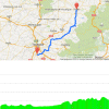
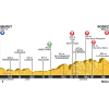
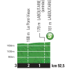
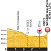
The cathedral in Rodez is big and ‘muscular’, making it a perfect location to celebrate a triumph. Chances are that honor will befall riders like John Degenkolb and Peter Sagans. Men who can digest mountains and still have an appetite to sprint. The race starts at an elevation of 80 metres to finish at 640 metres, whilst in between the pack races through a rolling landscape. The stage features a descent into the Tarn valley and the hills of the Aveyron are on the menu also. So that’s something for everyone, although in the end the punchy sprinters are most likely to glorify.
Only the old hands in the pack may remember since it’s been awhile, but part of today’s route was also in the 2007 time trial leading to Albi.
Live race report stage 13, Tour de France 2015
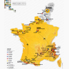
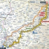
Tour de France 2015 stage 13: Route maps, height profiles, and more
Click on the images to zoom
+ Click for more images (7)
Related articles Riders and teams - Tour de France 2015 GC Favourites - Tour de France 2015 Withdrawals - Tour de France 2015 Route and stages - Tour de France 2015 More articles Tour of the Alps 2025 Route stage 3: Sterzing - Innechen
La Flèche Wallonne 2025: The Route
La Flèche Wallonne 2025: Riders
La Flèche Wallonne 2025: Favourites
La Flèche Wallonne Femmes 2025: The Route
La Flèche Wallonne Femmes 2025: Riders
Tour of the Alps 2025: Double win Storer in 2nd stage
Tour of the Alps 2025: Riders
Tour of the Alps 2025 Route stage 4: Sillian – Obertilliach
Tour of the Alps 2025 Route stage 5: Lienz – Lienz
Liège-Bastogne-Liège 2025: The Route
Liège-Bastogne-Liège 2025: Riders
Cycling Calendar 2025
Giro 2025: The Route
Giro 2025: Riders
Giro 2025: GC Favourites
Giro 2025 Route stage 1: Durazzo - Tirana
Giro 2025 Route stage 2: Tirana - Tirana
Giro 2025 Route stage 3: Valona – Valona
Giro 2025 Route stage 4: Alberobello – Lecce
Giro 2025 Route stage 5: Ceglie Messapica - Matera
Giro 2025 Route stage 6: Potenza - Naples
Giro 2025 Route stage 20: Verrès – Sestrière
Tour de France 2025: The Route
Tour de France 2025 Route stage 1: Lille - Lille
Tour de France 2025 Route stage 2: Lauwin-Planque - Boulogne-sur-Mer
Tour de France 2025 Route stage 3: Valenciennes - Dunkirk
Tour de France 2025 Route stage 16: Montpellier - Mont Ventoux
Tour de France 2025 Route stage 18: Vif - Col de la Loze





Are there any more detailed maps available. Iy would help in booking accommodation
Tom,
there are currenly no more details maps, but we have already some campingspots in the area:
http://www.domainelacsdegascogne.eu,
http://www.lecaussanel.com,
http://www.camping-pre-fixe.com and
http://www.camping-les-genets.fr
hopefully this helps.
Good luck!