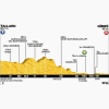
While the previous stage was one for the climbers, this is one for the downhill experts. The start is at 612 metres and the finish at 46 metres above sea level.
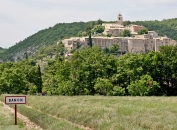
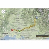
From the start, the first 45 kilometres go (slightly) downhill. From Les Bons Enfants, the road rises for about 15 kilometres to St Etienne les Orgues, which is at 712 metres. After a 6 kilometre (slight) decrease to La Pourcine, the riders face a 16 kilometres long false flat to Banon, the highest point of the day at 764 metres.
For the remaining 129 kilometeres the road drops 700 metres with a few bumps in the border region of Hautes-Alpes and Languedoc-Roussillon.
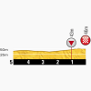
The last kilometres are pancake flat -so expect a very fast stage with a frenetic finale.
Tour de France 2014 stage 15: Images and more
Click on the images to zoom
+ Click for more images (3)
Related articles Riders and teams - Tour de France 2014 Favourites - Tour de France 2014 Withdrawals - Tour de France 2014 Mountains - Tour de France 2014 Route - Tour de France 2014 More articles Tour of the Alps 2025: Sprint victory and leader’s jersey for Ciccone
Tour of the Alps 2025 Route stage 1: San Lorenzo Dorsino - San Lorenzo Dorsino
Tour of the Alps 2025 Route stage 2: Mezzolombardo - Sterzing
Tour of the Alps 2025: Riders
Tour of the Alps 2025 Route stage 3: Sterzing - Innechen
Tour of the Alps 2025 Route stage 4: Sillian – Obertilliach
Tour of the Alps 2025 Route stage 5: Lienz – Lienz
La Flèche Wallonne 2025: The Route
La Flèche Wallonne 2025: Riders
La Flèche Wallonne 2025: Favourites
La Flèche Wallonne Femmes 2025: The Route
Liège-Bastogne-Liège 2025: The Route
Liège-Bastogne-Liège 2025: Riders
Cycling Calendar 2025
Giro 2025: The Route
Giro 2025: Riders
Giro 2025 Route stage 1: Durazzo - Tirana
Giro 2025 Route stage 2: Tirana - Tirana
Giro 2025 Route stage 3: Valona – Valona
Giro 2025 Route stage 4: Alberobello – Lecce
Giro 2025 Route stage 5: Ceglie Messapica - Matera
Giro 2025 Route stage 6: Potenza - Naples
Giro 2025 Route stage 7: Castel di Sangro - Tagliacozzo
Giro 2025 Route stage 19: Biella – Champoluc
Giro 2025 Route stage 20: Verrès – Sestrière
Tour de France 2025: The Route
Tour de France 2025 Route stage 1: Lille - Lille
Tour de France 2025 Route stage 2: Lauwin-Planque - Boulogne-sur-Mer
Tour de France 2025 Route stage 3: Valenciennes - Dunkirk
Tour de France 2025 Route stage 16: Montpellier - Mont Ventoux
Tour de France 2025 Route stage 18: Vif - Col de la Loze


