Giro d’Italia 2016 Route stage 9: Radda – Greve
Slideshow 1/11
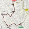
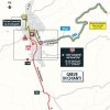
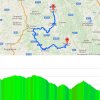
Sunday, May 15, 2016 – Stage 9 of the 2016 Giro d'Italia brings a 40.5 kilometres individual time trial in the hills of Toscane. Amidst the vine-yards of the Chianti region the course leads from Radda to Greve. No unbearable steepness, yet the route is going up and down without respite.
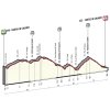
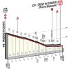
The start is in Radda at an elevation of 540 metres and the finish in Greve is at 307 metres. So across the board the stage goes down, but in between there are definitely some nasty uphill sections.
The stage offers a feel good opening, as the first 600 metres are going down at 6%. Then it’s 2% uphill for 5.1 kilometres, before a rolling section of 8.7 kilometres takes the riders to the highest point of the day: Macia Marta, located at an elevation of 619 metres. Obviously, a drop comes next – 9 kilometres at 3%.
The finale offers a false flat (2 kilometres at 2%), a descent (3.3 kilometres at 3.5%), a climb (4.9 kilometres at 3.6%) and eventually a 6.7 kilometres drop at 3.2%.
The hilly ITT through the Chianti region is almost 20 kilometres shorter than the ITT in the 2014 Giro. Vasil Kiryienka was fastest, while one could argue Fabio Aru lost the Giro that day as Alberto Contador put 2’47″ into the young Italian. When finishing in Milano on the last day Aru was 1’53″ down on El Pistolero.
Today’s intermediate check pointt are after 11.6 kilometres, 22.3 kilometres and 33.6 kilometres (at the top of the last hill).
Race results/race report stage 9, Giro d’Italia 2016.
Giro 2016 Stage 9: Height profiles, route maps, and more
Click on the images to zoom
+ Click for more images (7)
Watch the highlights of recent races here:
Related articles Riders - Giro d'Italia 2016 Favourites and GC contenders - Giro d'Italia 2016 Route and stages - Giro 2016 More articles Tour of the Alps 2025 Route stage 5: Lienz – Lienz
Tour of the Alps 2025: Epic solo win earns Arensman leader's jersey
Liège-Bastogne-Liège 2025: The Route
Liège-Bastogne-Liège 2025: Riders
Liège-Bastogne-Liège 2025: Favourites
Liège-Bastogne-Liège Femmes 2025: The Route
Liège-Bastogne-Liège Femmes 2025: Riders
Cycling Calendar 2025
Giro 2025 Route stage 1: Durazzo - Tirana
Giro 2025 Favourites stage 1: Puncher's sprint for pink
Giro 2025 Route stage 2: Tirana - Tirana
Giro 2025 Favourites stage 2: Chrono specialists to the fore
Tour of the Alps 2025: Riders
Giro 2025: The Route
Giro 2025: Riders
Giro 2025: GC Favourites
Giro 2025 Route stage 3: Valona – Valona
Giro 2025 Route stage 4: Alberobello – Lecce
Giro 2025 Route stage 5: Ceglie Messapica - Matera
Giro 2025 Route stage 6: Potenza - Naples
Giro 2025 Route stage 20: Verrès – Sestrière
Tour de France 2025: The Route
Tour de France 2025 Route stage 1: Lille - Lille
Tour de France 2025 Route stage 2: Lauwin-Planque - Boulogne-sur-Mer
Tour de France 2025 Route stage 3: Valenciennes - Dunkirk
Tour de France 2025 Route stage 16: Montpellier - Mont Ventoux
Tour de France 2025 Route stage 18: Vif - Col de la Loze

