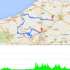
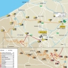
The name may suggest otherwise, but for over a decade Gent-Wevelgem hasn’t started in Ghent. The riders leave from Deinze, some 20 kilometres away, to traverse the flat fields of Flanders. With slightly over 100 kilometres done they cross the border to France and it’s there the first hills appear. After 140 kilometres in the saddle Mont des Chats offers a 500 metres climb at 9% and 8 kilometres later Mont Kokereel, Vert Mont and Mont Noir have also been crested.
With 163 kilometres done the pack is back in Belgium to tackle Baneberg for the first time. At 300 metres not a long climb at all, but beware of the steepest sectors at 20%. A little later Kemmelberg is to be climbed on the easy side, still this accounts for a maximum grade at 17%, while the 3 kilometres slopes offer an average gradient of 4%. 4 kilometres down the road Monteberg accounts for a 1 kilometre ascent at 7%.
Both Baneberg and Kemmelberg are in the road book twice and it’s after 200 kilometres in the saddle they reappear. Especially Kemmelberg is impressive as the second ascent is on the western side, not only meaning cobbles but also a steepest sector at 23%.
At the top of Kemmelberg the riders have 35 kilometres left to race.
Results/ race results Gent-Wevelgem 2016.
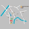
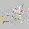
Gent-Wevelgem 2016: Route maps, height profile, and more
Click on the images to zoom
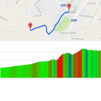 Route and profile Kemmel-Kemmelberg
 Instagram #kemmelberg
 Kemmelberg at strava.com
 Streetview Kemmelberg
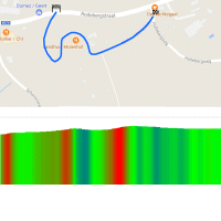 Route and profile Baneberg
 Instagram #kemmelberg
 Baneberg at strava.com
 Streetview Baneberg
